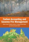
In the context of Australia’s developing carbon economy, fire management helps to abate emissions of greenhouse gases and is an important means of generating carbon credits. The vast high-rainfall savannas of northern Australia are one of the world’s most flammable landscapes. Management of fires in this region has the potential to assist with meeting emissions reduction targets, as well as conserving biodiversity and providing employment for Indigenous people in remote parts of Australia’s north.
This comprehensive volume brings together recent research from northern Australian savannas to provide an internationally relevant case study for applying greenhouse gas accounting methodologies to the practice of fire management. It provides scientific arguments for enlarging the area of fire-prone land managed for emissions abatement. The book also charts the progress towards development of a savanna fire bio-sequestration methodology. The future of integrated approaches to emissions abatement and bio-sequestration is also discussed.
- Page 1Abstract
The northern savannas, occupying a quarter of the Australian land mass, constitute the most fire-prone landscapes of a fiery land – in recent years, on average, 18% of the savannas have been burnt each year. Land use is predominantly given over to extensive beef cattle pastoralism – although over much of the rangelands this is at best an economically marginal activity, especially in frequently burnt, higher rainfall northern regions. Outside of urban centres most of the savanna human population is Indigenous, increasingly rapidly, and remains impoverished. Much of the northern cadastre is Indigenously owned outright, or is subject to continued rights of access and use under Native Title arrangements. In this paper we articulate a distinctly northern Australian understanding of and approach to the management of fire, matched to the biophysical and social realities of the north. Despite many obstacles to effective management associated with remoteness, sparse population and limited transport and other infrastructure, management of fire can be improved for positive ecological and social outcomes over a large part of the Australian land mass. Taking advantage of emerging carbon and biodiversity environmental services developments, skilled fire management offers a culturally apt enterprise opportunity where few others exist.
- Page 23Abstract
Anthropogenic fires in Australia’s fire-prone savannas produce up to 3% of the nation’s accountable greenhouse gas emissions. Incentives to improve fire management have been created by a nationally accredited savanna burning emissions abatement methodology applying to 483 000 km2 of relatively high rainfall (>1000 mm p.a.) regions. Drawing on 15 years of fire mapping, this chapter assesses appropriate biophysical boundaries for a savanna burning methodology extended to cover lower rainfall regions. We examine a large random sample of points with at least 300 mm of annual rainfall, to show that: (1) relative fire frequencies (percentage of years with fire) decline from 33.3% in higher rainfall regions (>1000 mm) to straddling ~10% in the range 300–700 mm; (2) there are no marked discontinuities in fire frequency or fire seasonality down the rainfall gradient; (3) at all annual rainfalls, fire frequency is higher when rainfall is more strongly seasonal (very low rainfall in the driest quarter); (4) below 500 mm fire regimes are particularly variable and a large proportion of sampled sites had no fire over the study period; (5) fire is more likely to occur later in the fire season (generating relatively higher emissions) in the 600–700 mm annual rainfall band than in other parts of the rainfall gradient; (6) woodland savannas are most common above and predominantly grassland systems are more common below ~600 mm annual rainfall.
We propose that development of a complementary lower rainfall savanna burning methodology should apply to regions between 600 and 1000 mm annual rainfall and ≤15 mm of rainfall in the driest quarter, adding an area more than 1.5 times the existing methodology’s coverage. Given greater variability in biophysical influences on fire regimes and observed levels of fire frequency within this lower rainfall domain, we suggest that criteria for determining baseline (pre-project) periods require estimates of mean annual emissions equivalent in precision to the project on which the higher rainfall methodology was based.
- Page 57Abstract
Our current understanding of global fire regimes is largely informed through satellite-derived fire mapping. The primary sources of satellite imagery are the continental-scale Moderate Resolution Imaging Spectroradiometer (MODIS) and Advanced Very High Resolution Radiometer (AVHRR) sensors from which are derived active fire, ‘hot spot’, and post-fire, burnt area, mapping. The mapping is particularly important for management in the highly fire-prone savanna landscapes of northern Australia, and also provides insights into the environmental, social and economic impacts of fire. Since 2003, fire mapping for northern Australia has been produced from MODIS data using a semi-automated object-based classification technique. Importantly, these data are updated regularly and made available through the North Australian Fire Information (NAFI) web portal for fire management planning and carbon and greenhouse gas emissions accounting. The robust nature of this dataset and its high public profile through NAFI have led to its becoming the baseline mapping legislated for use in the savanna burning greenhouse gas emissions abatement scheme, already approved for the higher rainfall regions of northern Australia.
In this chapter we describe the processes for producing the MODIS-derived burnt area mapping served through NAFI. We then undertake a thorough validation using an independent and extensive point dataset and compare it to a series of automated global fire mapping datasets through regression analysis of Landsat-derived burnt area mapping across five scenes in two seasons of 2 years.
The results demonstrate a high level of confidence in the product, with an overall accuracy of 88% when compared to the field data. When compared to other fire datasets the NAFI data was consistently more accurate. The accuracy of the global datasets decreased by nearly half compared to the NAFI and DLI AVHRR data when mapping smaller early dry season burnt areas. This is significant as these areas often have important implications for operational fire management. This suggests that although providing useful statistics (e.g. percentage area burnt, seasonality and frequency of fire), automated global and coarser resolution fire products are of limited use in operational land management. We suggest that for an operational product to be adopted by fire managers, a human operator is required in the mapping process to react to user requirements, and that an object-oriented classificatory approach, which more closely mimics human interpretation, provides a higher level of visual sophistication and accuracy to burnt area mapping.
- Page 73Abstract
A key requirement for registered fire abatement projects under Australia’s Carbon Farming Initiative (CFI) is a map of the vegetation fuel types. Designated vegetation fuel types are functional groups describing a relatively homogenous broad-scale area of flammable (fire-dependent or fire-sensitive) vegetation characterised by a common suite of fuel components and which exhibit characteristic emission responses to fire. Each type is fundamentally a structural vegetation group with a distinctive ground cover. The chapter first describes broad fuel types unique to the regional envelope encompassing the proposed savanna burning lower rainfall (1000–600 mm) zone. At least five vegetation fuel types (woodlands over tussock grasses; woodlands over mixed tussock and hummock grasses; woodlands over hummock grasses; open woodlands over hummock and tussock grasses; shrublands over hummock grasses) meet requisite criteria for inclusion in the CFI. The latter part of the chapter addresses issues relating to appropriate mapping and validation requirements.
- Page 97Abstract
This chapter investigates the operational use of satellite-sourced fire data by projects implementing the savanna burning methodology, drawing on the knowledge of the fire planners involved in these projects. It shows that there is extensive use of satellite-sourced fire data in the projects, and that implementation of the methodology depends on these data. The use of these data extends throughout the fire season and involves a range of formats and tools. Almost all these data are sourced from, or used with, the North Australian Fire Information (NAFI) service. The importance of the NAFI service for the implementation of the savanna burning methodology underlines the need to effectively manage risk and ensure the service is reliable.
- Page 115Abstract
This chapter outlines field studies and subsequent analyses undertaken for the purposes of deriving robust parameter values for fuel load accumulation (FLA), fire patchiness (P), and burning efficiency factors (BEF) for incorporation into a savanna burning emissions abatement methodology for areas of lower rainfall (600– 1000 mm p.a.). We apply a broadly similar methodology to that developed for the current higher rainfall (>1000 mm p.a.) savanna burning abatement methodology. FLA data were assembled from 648 transects sampling the full rainfall envelope over a wide variety of landscape conditions that support characteristic unmodified flammable savanna vegetation structural types. Patchiness data were assembled from 3325 observations utilising three assessment methods. Fuel combustion (pyrolysis) and BEF data were derived from 90 fire treatments under a range of fire severity conditions, and categorisation of fire severity under early dry season (EDS) and late dry season (LDS) conditions was derived from observations of 392 fires at 267 permanent plots over the period 2009–2013.
Mean total fuel loads in the early (5.66 t ha–1) and late (6.15 t ha–1) dry seasons, and those of constituent components (fine fuels, coarse woody fuels, heavy woody fuels, shrub fuels), were less than those sampled under higher rainfall conditions. Based on data presented in Chapter 7, most input of litter fuel (leaf, twigs) occurred in the LDS (73%) (after August). Accumulation of fine fuels was effectively described by Olson curve and regression models for each of six vegetation/fuel types (described in Chapter 4), but not for lancewood and tussock grasslands fuel type combinations. Fires were observed to be more patchy early (79% of area burnt) than late (97%) in the dry season. BEFs for fuel components were observed to vary little between EDS and LDS, and overall were lower for coarse (sticks) and heavy (logs) woody debris components, and shrub fuels. Fine fuels exhibited high BEFs given a much larger grass component and subsequent more complete pyrolysis although, overall, our data suggest that fire treatments were of lesser intensity than observed under higher rainfall conditions. This assessment indicates that, for implementing a savanna burning abatement project in lower rainfall areas, two parameters are of particular importance – accumulation of greater proportions of fuel loads with litter inputs later in the season, and patchier early season fires.
- Page 133Abstract
The distribution and proportional composition of leaf litter (<0.6 mm diameter) and coarse litter (woody debris, 0.6–5 cm diameter) play an important role in fire fuel dynamics in tropical savanna ecosystems. This chapter details geographic and seasonal variation in the rate and volume of leaf litter and coarse litter fuel accumulation in evergreen Eucalyptus miniata and E. tetrodonta-dominated open forests and woodlands along a rainfall gradient (750–1600 mm) in the Northern Territory. The aim is to provide a basis for correlating remotely sensed measures of vegetation attributes (height, basal area, cover) with fine fuel accumulation, a key variable for emissions calculation.
Leaf litter accumulation rates were found to vary significantly with rainfall and tree basal area. The seasonality of leaf litter accumulation was found to vary most significantly with rainfall and latitude. Under higher rainfall (>1000 mm p.a.), mean leaf litter input was 5.01 ± 0.48 Mg ha–1 yr–1, with 54% occurring in the late dry season (LDS) period after July. Under lower rainfall (<1000 mm p.a.), mean leaf litter input was 2.87 ± 0.41 Mg ha–1 yr–1, with 74% occurring in the LDS period. Mean coarse litter inputs were 0.55 Mg ha–1 yr–1and 0.22 Mg ha–1 yr–1, at higher and lower rainfall sites, respectively. Although seasonal differences were observed in coarse litter inputs, these were not associated with vegetation structural characteristics and it is suggested that, at plot scales, such inputs rather reflect disturbance events (e.g. high winds, severe fires).
Seasonal differences in leaf litter fuel loads are likely to contribute to significant differences in the total fine fuel loads between the early and late dry season, especially in the <1000 mm rainfall zone. Generally, these results reflect plant community compositional and hypothesised plant ecophysiological differences along the rainfall gradient. Rates of leaf litter accumulation in Top End savannas appear to be consistently greater than in other evergreen eucalypt formations outside the wet– dry tropics. Difficulties associated with the accurate quantification of coarse-woody debris accumulation at the plot scale are also highlighted, and recommendations for further studies to better quantify the range of variation in fine fuel accumulation rates within tropical savanna ecosystems are discussed.
- Page 169Abstract
This chapter addresses the application of, and challenges associated with, satellite-based fire severity mapping in north Australian savanna landscapes. Fire severity describes the effects of fire on vegetation and can be classified by simple semiquan-titative schemata. In savannas, fire severity typically is classified as low (fires are patchy, consuming only the grass and litter layer), moderate (fires affect the woody mid-storey foliage), or high (fires affect the upper canopy). We present important applications of fire severity mapping in fire management operations, ecological assessments, and greenhouse gas emissions accounting. We first describe recent research undertaken to characterise fire severity mapping using satellite imagery, informed by substantial ground- and aerial-based calibration and validation assessments.
While current fire severity models show considerable promise, a particular challenge remains to discriminate high severity fires reliably. We then consider how available fire severity data can help inform the development of a savanna burning abatement methodology in the lower rainfall (600–1000 mm mean annual rainfall) region. We propose that fire severity in lower rainfall savanna situations is usefully described by a two-class model (not-severe, severe), and that, given current challenges with fire severity mapping, early (EDS) and late (LDS) dry season fire severity characteristics are best described using a site-based approach, in line with the methods applied in the higher rainfall methodology. In time, reliable automated satellite-based fire severity mapping processes will allow for application of spatially explicit, dynamic, and hence more flexible savanna burning emissions accounting frameworks.
- Page 185Abstract
The savanna woodlands of northern Australia contribute annually ~3% of Australia’s net accountable greenhouse gas emissions. In recent years the development of fire management techniques based on the traditions of the Indigenous land owners has demonstrated that these emissions can be reduced by carefully planned and implemented prescribed burning. This led to the development of a certified methodology for claiming tradable carbon credits under Australia’s Carbon Farming Initiative (CFI). The methodology was applicable only to savannas with a mean annual rainfall greater than 1000 mm. Greenhouse gas emission rates are determined by fuel composition; the fine fuels in this region are predominantly tree litter, with grasses dominating in only a few vegetation communities, and therefore the accounting methodology is suitable only for litter-dominated vegetation communities. However, there are extensive areas of the savanna woodlands in low rainfall regions where grasses dominate the fine fuels. Skilled fire management in these regions can also lead to reduced greenhouse gas emissions; however, quantifying the emissions reductions with the accuracy required for certifiable carbon credits requires the development of new accounting methodologies. A critical component of the process is evaluating the parameters of the accounting algorithm. This chapter reviews the procedures for assessing emission factors and the assumptions and pitfalls involved in assigning accurate values to a parameter set to produce project-based inventory methodologies suitable for emission accounting of low rainfall savanna fires.
- Page 219Abstract
This chapter sets out the recommended calculation framework for lower rainfall savanna burning projects as a formal methodology for inclusion in Australia’s national agricultural emissions offset program, the Carbon Farming Initiative. With reference to three project-scale worked examples, the chapter illustrates that three factors have a significant bearing on achievable emissions abatement: the size of the project area, the proportional extent of respective fuel types, and the baseline fire frequency.
- Page 235Abstract
This chapter presents an assessment of the potential for using ‘top-down’ accounting methodologies to constrain or replace ‘bottom-up’ accounts. The increasing availability of remotely sensed spatial datasets of fire activity and atmospheric concentrations of the emission products from biomass combustion presents an opportunity for greenhouse gas accounting methodologies that are independent of the current bottom-up methods. Three potential applications for top-down accounting are identified: (1) independent assessment of the accuracy of bottom-up accounts; (2) a method for constraining bottom-up emission estimates to match the observed atmospheric concentrations of emitted compounds; and (3) a fully independent method for determining regional emissions.
Assessment of consistency between independent datasets used as input to bottom-up accounts confirmed that current Australian practice and method yield emission estimates that are reliable. However, global data products appear to significantly underestimate fire area in the Australian savanna woodlands and range-lands, and overestimate fuel loads. Regional monitoring and analysis is therefore essential for regional accounts.
Atmospheric dispersion models of proven accuracy in the Australian region, coupled with a chemical transport model, are also found to perform reasonably reliably in Australian applications. This confirms that current emissions estimates produce atmospheric concentrations of smoke that are consistent with observed concentrations. At three observing sites (Lake Argyle, Darwin and Jabiru), there is good correspondence between the magnitude and seasonal variation in aerosol optical depth (AOD) – the loading of particulate matter observed though the atmospheric column. This could only be achieved by accounting for all sources of aerosol (i.e. marine, wind-blown dust, secondary aerosol produced from biogenic sources of volatile organic compounds, and both fresh and aged smoke). Model predictions of the smoke contribution to total AOD were slightly smaller than indicated by the surface measurements. This work is consistent with previous studies, but indicates that the empirical methods used in previous studies may have overestimated the significance of smoke relative to other aerosol sources. Clearly, some components of the chemical transport model require further refinement to fully describe the known aerosol chemical and physical transformations in the atmosphere.
There is also good agreement between AOD predicted from emissions estimates and AOD predicted from atmospheric transport with observations of smoke plumes derived from lidar backscattering profiles from the Cloud-Aerosol Lidar Infrared Pathfinder Satellite Observations (CALIPSO) satellite. However, the comparison was limited by the mismatch between the spatial resolution of the model and that of the CALIPSO observations.
To develop the top-down technique to the point where it can be used to constrain and even replace bottom-up accounts will require further refinement of model components and development of inverse modelling software. While both are currently in planning, it appears unlikely that top-down accounting can be applied in the near future for totally independent accounting due to the limited precision and temporal coverage of the satellite observations.
- Page 273Abstract
The processes that allow the coexistence of trees and grasses in tropical savannas have long intrigued ecologists. Early theories had a strong focus on climatic controls, but over the last two decades a conceptual model has emerged suggesting that savanna trees are subject to a fire-mediated recruitment bottleneck. Under this model, frequent savanna fires prevent recruitment of saplings into the tree layer, and this bottleneck maintains tree biomass below a climate-determined carrying capacity. We propose that the relevance of this conceptual model, which is based largely on African savanna research, has been substantially overemphasised in the northern Australian context. In this region, the overall abundance of trees in savannas is very strongly controlled by water availability, not fire. There is considerable evidence that the dominant trees of Australian savannas – eucalypts – are one of the most fire-tolerant tree lineages on Earth, and have a remarkable capacity to grow rapidly through the ‘fire trap’ and reach fire-resistant sizes. The extreme fire tolerance of savanna eucalypts makes them relatively unresponsive to reductions in fire frequency and intensity. In contrast, other groups of trees in Australian savannas typically have a much lower capacity to escape the fire trap, and therefore respond positively in abundance to reductions in fire frequency and intensity. From an applied perspective, there have been suggestions that managers could sequester substantial quantities of carbon (thereby offsetting anthropogenic greenhouse gas emissions) by reducing the frequency and intensity of savanna fires and, hence, increasing tree biomass. We contend that if tree biomass in Australian savannas is strongly limited by water availability, then the potential for fire management to increase tree biomass is relatively limited, at least in relation to the dominant eucalypt component. There may be potential to increase the abundance of the more fire-sensitive non-eucalypt tree component, but the biomass carrying capacity of non-eucalypts in this eucalypt-dominated system remains poorly understood, including whether there is a trade-off between eucalypt and non-eucalypt biomass.
- Page 295Abstract
This chapter presents the results of two approaches to predicting the long-term effects of fire regimes on the carbon stocks in Australian tropical savannas. The first approach applies a statistical model to the Three Parks data from Kakadu, Litchfield and Nitmiluk national parks to project observations of carbon stock changes in live trees over 5-year periods to a century. The second applies the FLAMES model to predict the effect of a changed fire regime on equilibrium carbon stocks in live trees, fine fuel and coarse woody debris. We conclude that a process-based modelling approach, such as FLAMES, provides a more robust and conservative prediction of the positive effect of fire management on carbon stocks than does simple extrapolation of a statistical model of short-term changes in carbon stocks, which cannot account for homeostatic and long-term demographic effects.
- Page 321Abstract
An approach to developing a methodology for carbon sequestration in dead fuels through the implementation of less severe fire regimes in savannas of northern Australia is described. The approach is intended to be complementary to the existing emissions abatement methodology. It accounts for carbon stock changes in above-ground fine and coarse fuels as a result of changing the frequency of fires and the proportion of early dry season fires.
- Page 329Abstract
This final chapter provides an overview and discussion of various significant issues and ongoing challenges that have been identified in, or arise from, discussion in the earlier chapters. Our coverage addresses a variety of key topical areas, including development and presentation of integral mapping products, ongoing abatement and sequestration methodology challenges, and challenges associated with project implementation, governance, and supportive policy settings. We identify several critical issues and sources of uncertainty that should be the focus of future research effort.


